Lightning Animation Full Disc
The animation displays the Level 2 LI Accumulated Flash Area (AFA) product for September 24, 2024, between 05:00 and 07:00 UTC. The base layer uses FCI HRFI IR 10.5 µm data from EUMETSAT.
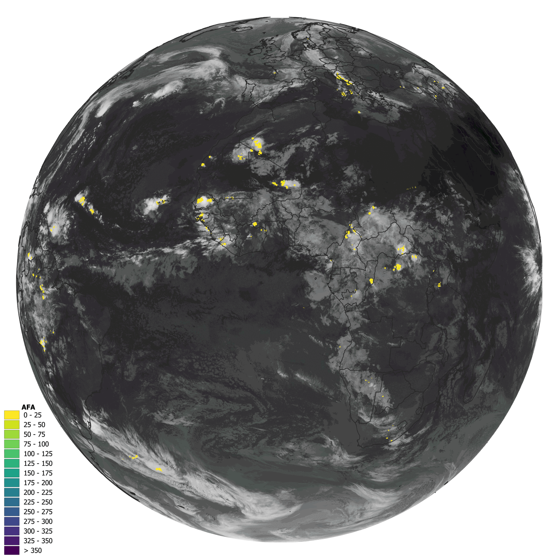
Figure 1. Animation over Europe, Africa, the Middle East, and parts of South America displaying the Level 2 LI Accumulated Flash Area (AFA) product for September 24, 2024, from 05:00 to 07:00 UTC.
Animation Over Europe and Northern Africa
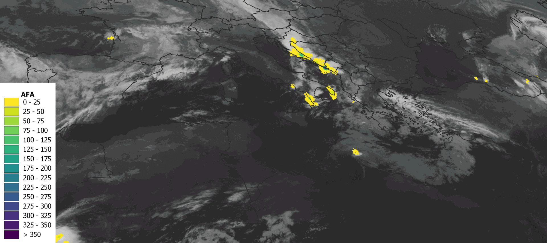
Figure 2. Animation over Europe and northern Africa displaying the Level 2 LI Accumulated Flash Area (AFA) product for September 24, 2024, from 05:00 to 07:00 UTC.
Lightning Animation Full Disc
The animation displays the Level 2 LI Accumulated Flash Area (AFA) product for October 5, 2024, between 17:00 and 19:00 UTC. The base layer uses FCI HRFI IR 10.5 µm data from EUMETSAT.
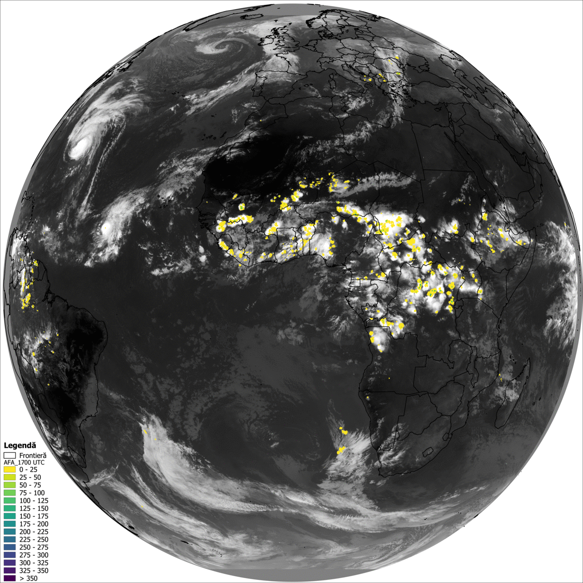
Figure 3. Animation over Europe, Africa, the Middle East, and parts of South America displaying the Level 2 LI Accumulated Flash Area (AFA) product for September 24, 2024, from 05:00 to 07:00 UTC.
Animation Over Europe and Northern Africa
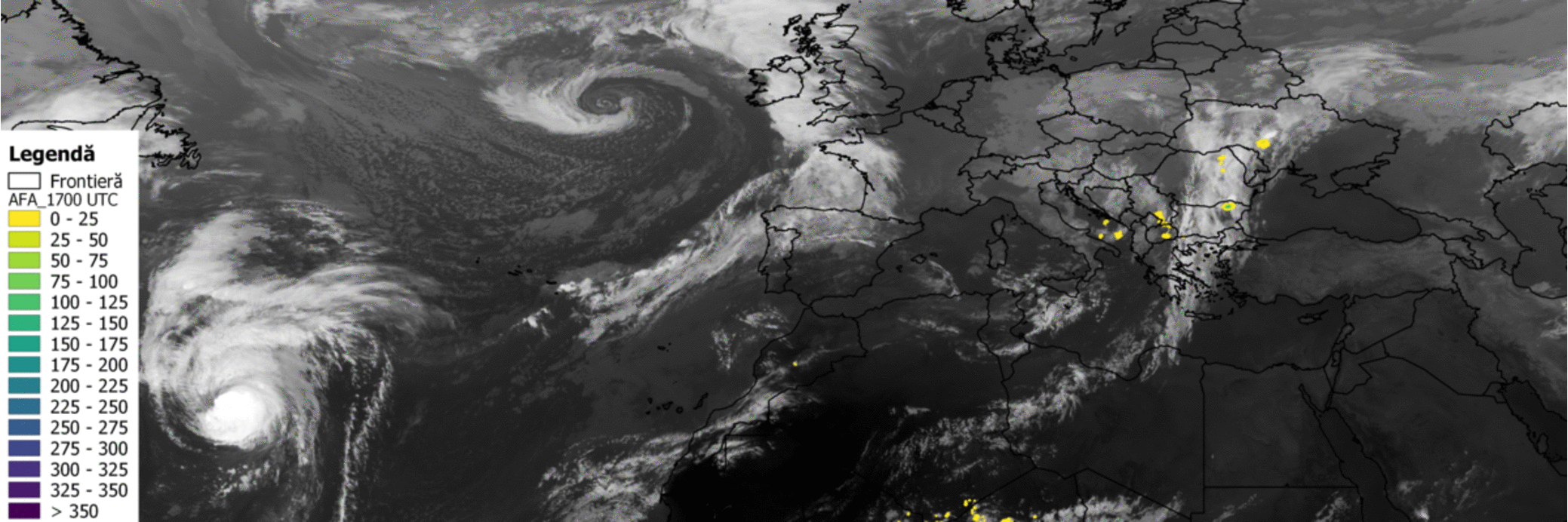
Figure 4. Animation over Europe and northern Africa displaying the Level 2 LI Accumulated Flash Area (AFA) product for October 5, 2024, from 17:00 to 19:00 UTC.
Comparison with data from the Romanian ground-based Lightning Location Network
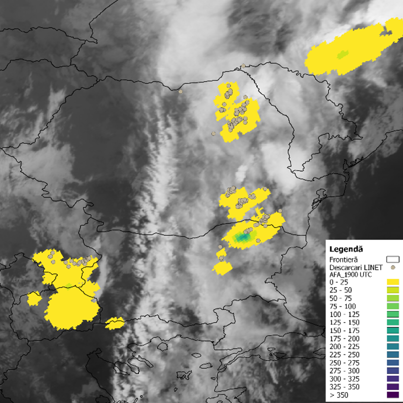
Figure 5. Comparison between the Level 2 LI Accumulated Flash Area (AFA) with data from the Romanian ground-based Lightning Location Network for October 5, 2024, from 17:00 to 19:00 UTC.
Another comparison with data from the Romanian ground-based Lightning Location Network
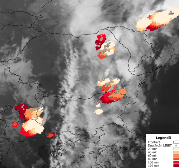
Figure 6. Another comparison between the Level 2 LI Accumulated Flash Area (AFA) with data from the Romanian ground-based Lightning Location Network for October 5, 2024, from 17:00 to 19:00 UTC.
Visualization on ADAGUC Viewer
A Python prototype has been already implemented on the European Weather Cloud (EWC) and its results (for the last 3 hours, 10 minutes accumulations) are available by accessing: ADAGUC Viewer.
Training Section: Steps
| Step | Image |
|---|---|
| Step 1 |  |
| Step 2 |  |
| Step 3 |  |
| Step 4 |  |
| Step 5 |  |
| Step 6 |  |
| Step 7 |  |
| Step 8 |  |
| Step 9 |  |
| Step 10 |  |
| Step 11 |  |
| Step 12 |  |
| Step 13 |  |
| Step 14 |  |
Overlaying with other products available on WMS services e.g. EUMETview. . |
|
| Step 15 |  |
| Step 16 |  |
| Step 17 |  |
| Step 18 |  |
| Step 19 |  |
| Step 20 |  |
| Step 21 |  |
| Step 22 |  |
| Step 23 |  |
| Step 24 |  |