 |
Not processed
Clear land
Clear sea
Snow land
Sea ice
Very low
Low
Mid. level
A High opaque
Very high opaque
Thin semi transparent
Meanly thick semi transparent
Thick semi transparent
Semi transparent above
Fractional
Undefined
|
 |
Not processed
Clear land
Clear sea
Snow land
Sea ice
Very low
Low
Mid. level
High opaque
Very high opaque
Thin semi transparent
Meanly thick semi transparent
Thick semi transparent
Semi transparent above
Fractional
Undefined
|
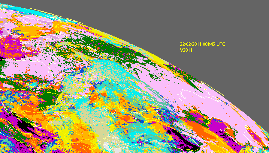
When processed at daytime on 22 February CT depicts that in general ground is snow covered for these two areas as illustrated below on the image produced for 08h45 UTC.
The difference between V2011 and V2010 is emphasized by the animation of the two CT at 02h45.
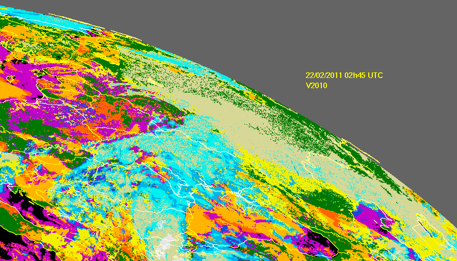
Such a situation is also observed on 23 and 24 february 2011. We analyse again the cloud cover as reported by SYNOP together with V2010 CT on 24 february. Obviously one can observe again persisting false cloud detections with V2010.
 |
Not processed
Clear land
Clear sea
Snow land
Sea ice
Very low
Low
Mid. level
High opaque
Very high opaque
Thin semi transparent
Meanly thick semi transparent
Thick semi transparent
Semi transparent above
Fractional
Undefined
|
 |
Not processed
Clear land
Clear sea
Snow land
Sea ice
Very low
Low
Mid. level
A High opaque
Very high opaque
Thin semi transparent
Meanly thick semi transparent
Thick semi transparent
Semi transparent above
Fractional
Undefined
|
 |
Not processed
Clear land
Clear sea
Snow land
Sea ice
Very low
Low
Mid. level
A High opaque
Very high opaque
Thin semi transparent
Meanly thick semi transparent
Thick semi transparent
Semi transparent above
Fractional
Undefined
|
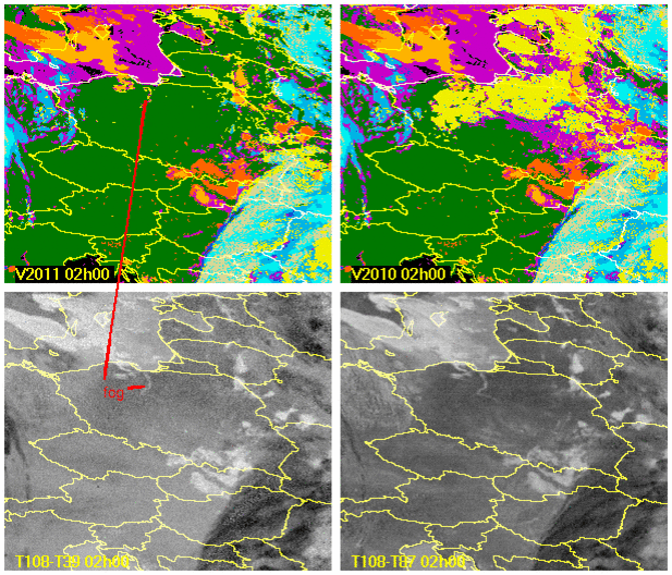
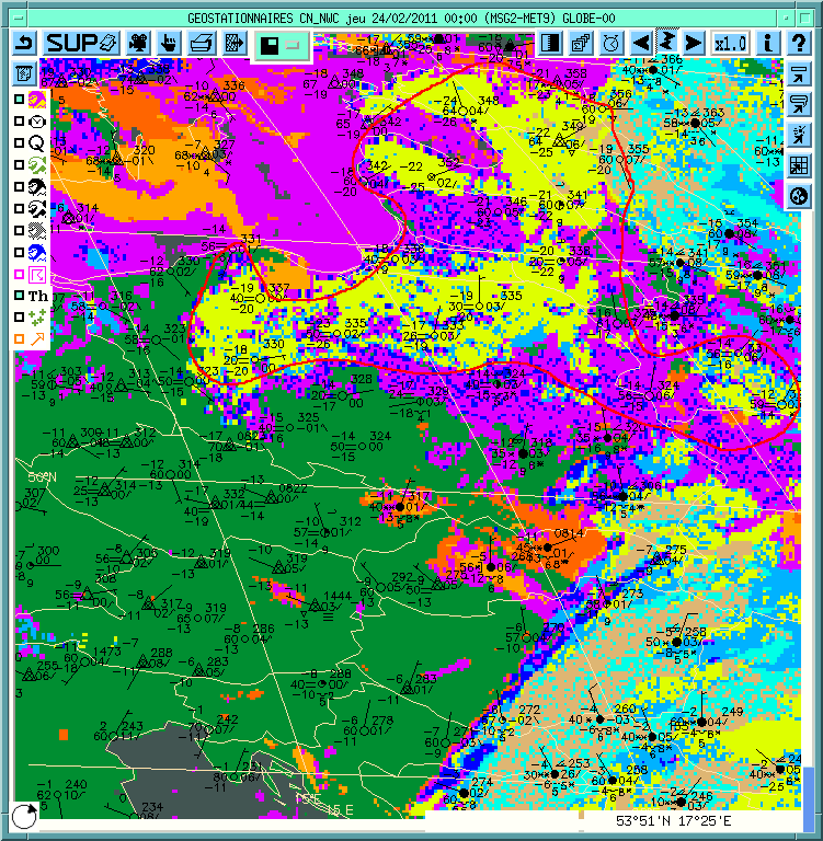
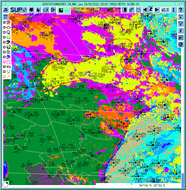
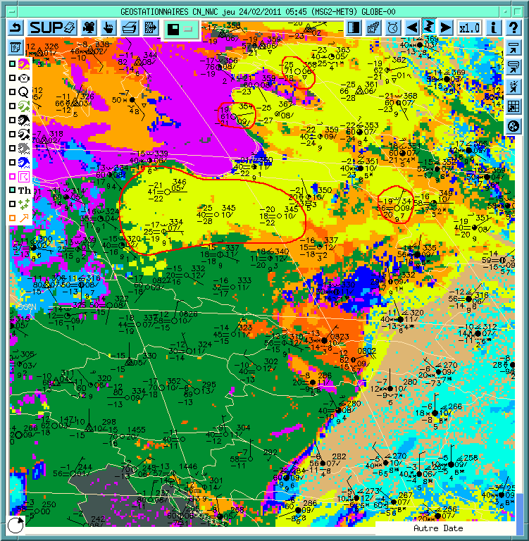
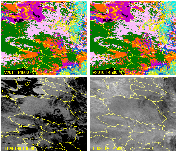
An animation loop between 23/02/2011 14h00 UTC and 24/02/2011 08h45 UTC shows that the v2011 cloud detection is better matched with SYNOP reports than V2010 CT. The SEVIRI spectral information behaviour is also illustrated by images of brightness temperature difference T108-T39 (scale[-10K,6K]) and T108-T87( scale[-2K,4K]). The false detection of clouds that occured rapidly with the sun set in V2010 CT is not observed any more when V2011 algorithm is used. Moreover we can note that the detection of low clouds in not hampered by the relaxation of the thresholds (for instance the fog over Vistula between the Gulf of Gdansk and Wloclawek is caught). Some high clouds may sometimes be missed, but their area remains limited in the fringe of thin semi-transparent high clouds.
 |
Not processed
Clear land
Clear sea
Snow land
Sea ice
Very low
Low
Mid. level
High opaque
Very high opaque
Thin semi transparent
Meanly thick semi transparent
Thick semi transparent
Semi transparent above
Fractional
Undefined
|
For instance, if we analyse in details the image at 02h00 we can see that the fog formation above Vistula between the Gulf of Gdansk and Wloclawek is caught by V2011. We can also note that there is still place for improvement to remove false cloud detections such as over sea ice on the Baltic sea, or over frozen lakes as over lake Balaton in Hungary