The online-processing for the Precipitating Clouds (PC) product derives the precipitation likelihood from AVHRR and microwave data.
The objective of the PC product is to support detailed precipitation analysis for nowcasting purposes,
especially in areas for which no radar data is available. The focus is on the delineation of non-precipitation
and precipitating clouds and on giving a rough indication on intensity to be expected.
Description of the output
The PC product consist of a numerical value for the likelihood of precipitation within the following four precipitation intensity classes:
No precipitation (R < 0.1 mm/hr)
Risk for (light) precipitation: 0.1 mm/hr < R < 0.5 mm/hr
Light/moderate precipitation: 0.5 mm/hr < R < 5.0 mm/hr
Intensive (convective) precipitation: 5.0 mm/hr < R
Following image is produced by version 1.4 of SAFNWC/PPS with was operational at that time. On the 23rd of May 2010 a low pressure passing eastwards over Sweden. The centre of the low passing near Stockholm at mid-day causing rain and showers over a vast area, even with some thunderstorms within the cold airmss over Sweden and the Baltic. Further east, over Russia and Belarus, there are also thunderstorms. North of Scotland and northern North Sea a new area with rain approaching southernmost Norway.
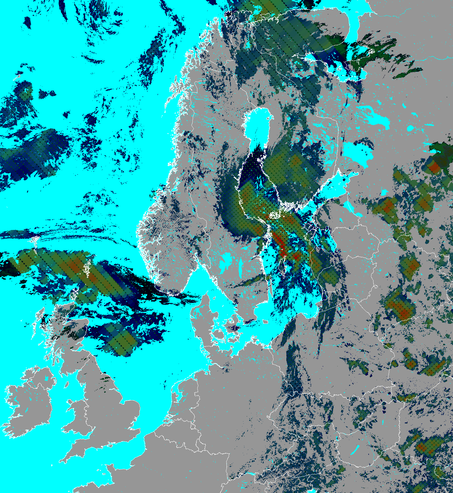 |
Colour coding:
The image of the PC product is created as
an RGB colour composite where:
layer 1 (red) is assigned to the
probability for precipitation intensity
class 3, intensive precipitation
layer 2 (green) is assigned to the
probability for precipitation intensity
class 2, light/moderate precipitation
layer 3 (blue) is assigned to the
probability for class 1, risk for
precipitation. |
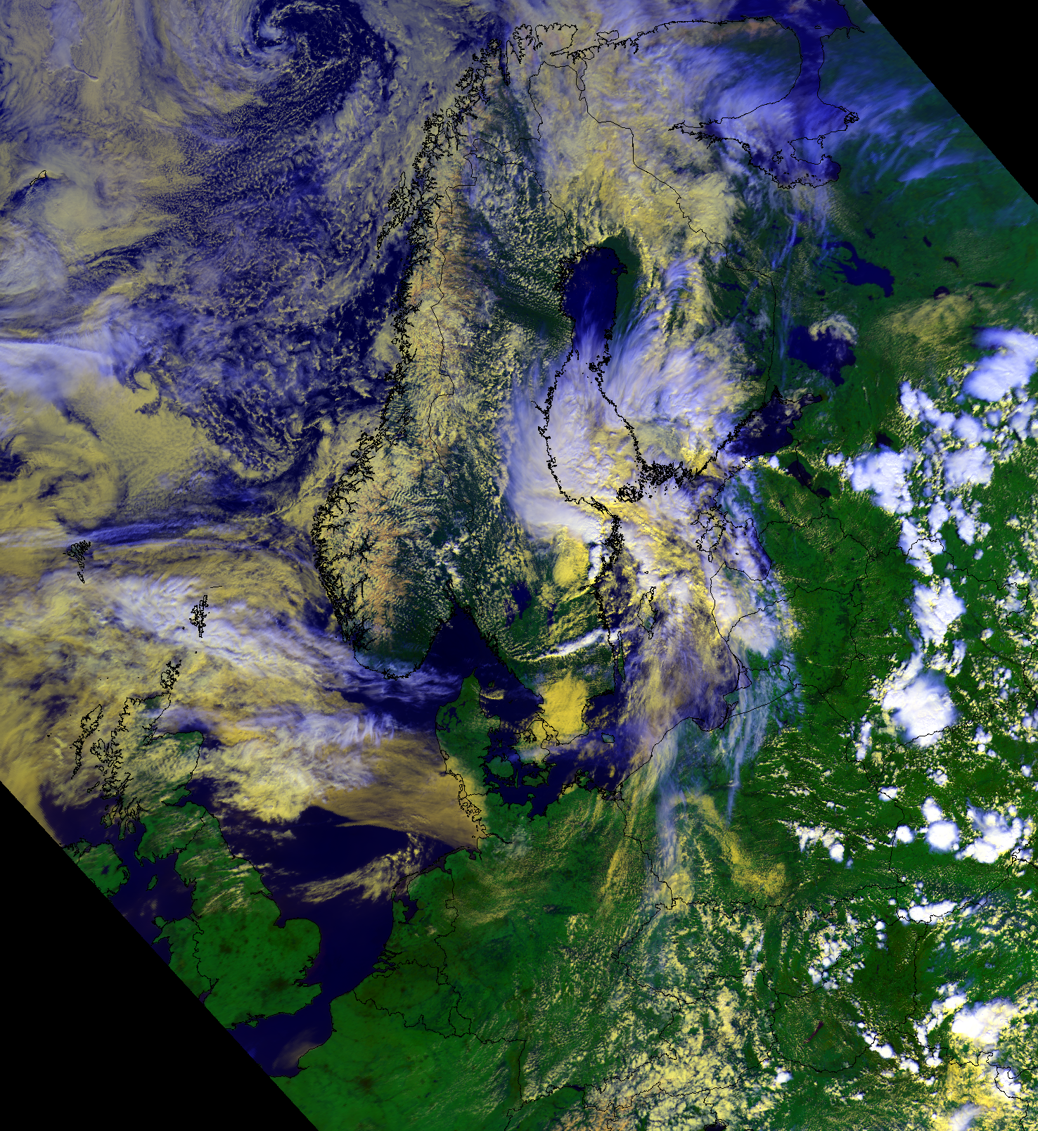
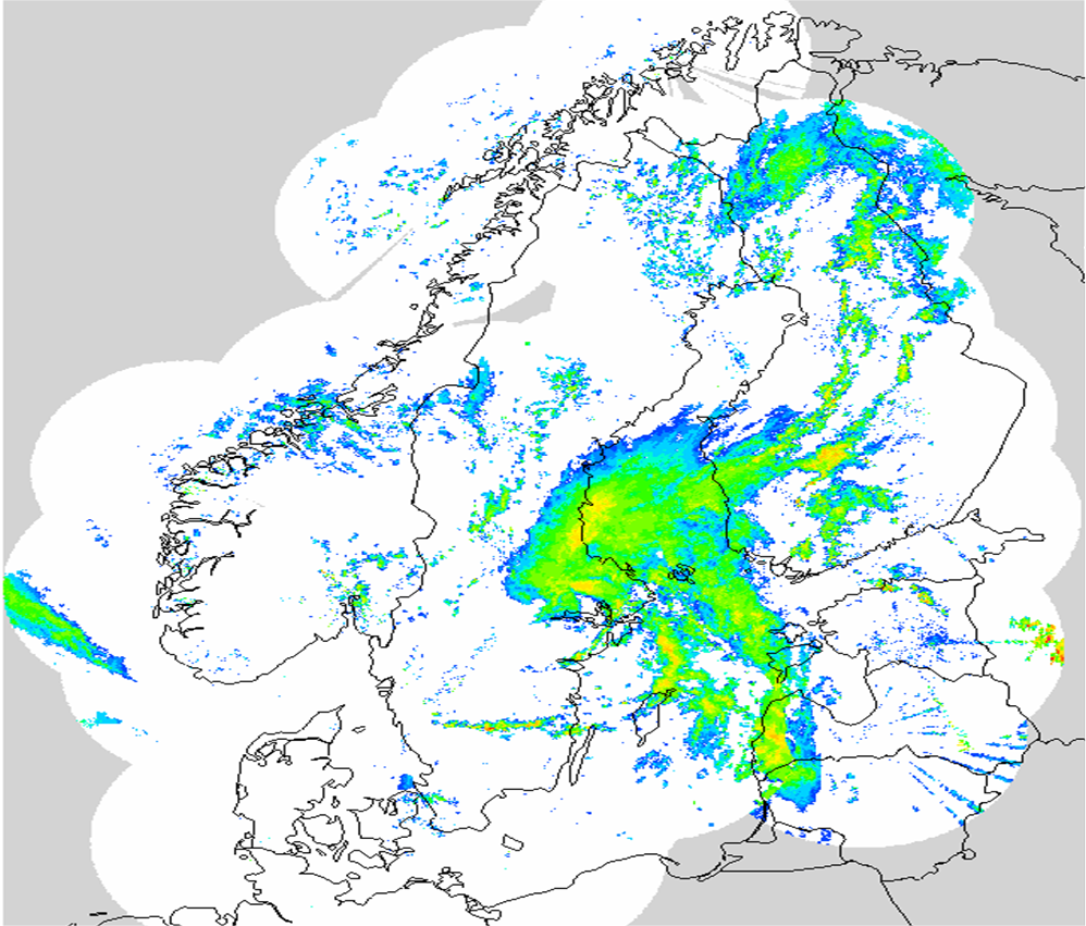
This example image of the PC product are data from a noaa19 overpass May 23, 2010, 11:27utc, received and processed at SMHI, Norrköping, Sweden. The
corresponding RGB images using AVHRR channel 1,2,4 and a radar composit from 11.30utc are shown just below. The radar composite is based on the nordic radar network.
 |
 |