RDT loop for the whole day

Synthetic analysis at 18UTC
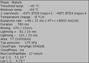 Tower base cell's attributes, including OTD description |
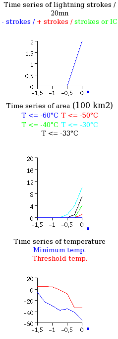
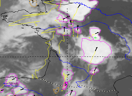
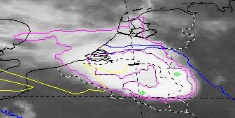 slot 13h, on 25th May 2009. Tower base and 2nd level contours. 1st level catch the whole system, whereas 2nd level highlights here U-shape top 2 overshoots are here diagnosed, marked by green dots |
 |
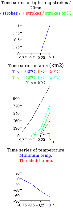
 slot 10h00 UTC (valid 10h11). First diagnosis of convective cell with strong cooling (left figure)  slot 14h30 UTC (valid 14h41) after 4h30 tracking, just before decaying stage light electrical activity (right figure) |
 |
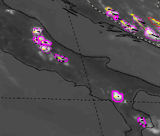
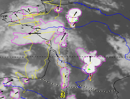
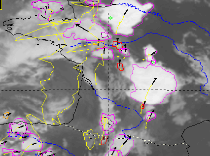
 slot 11h45 UTC (valid (11h56) |
 slot 12h30 UTC (valid 12h41) |
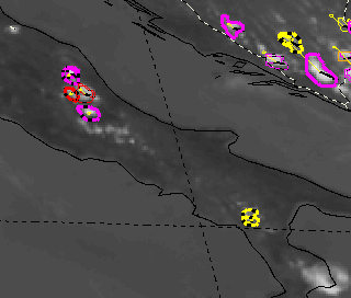
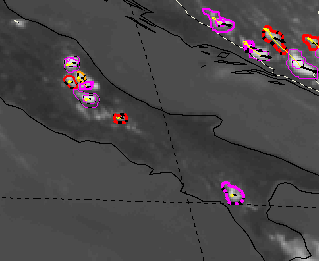
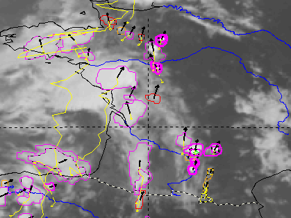
 slot 13h00 central Italy |
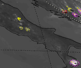
 slot 13h00 south Italy |
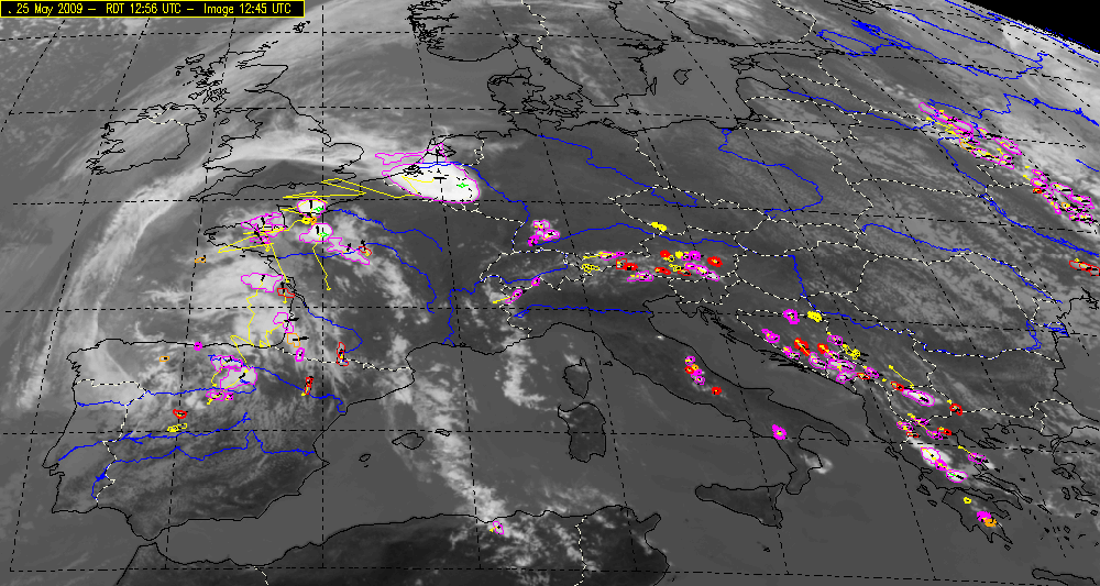
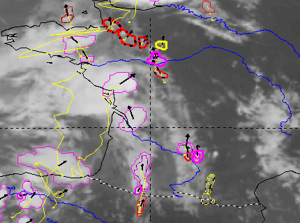
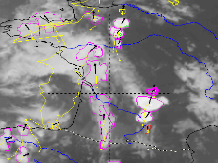
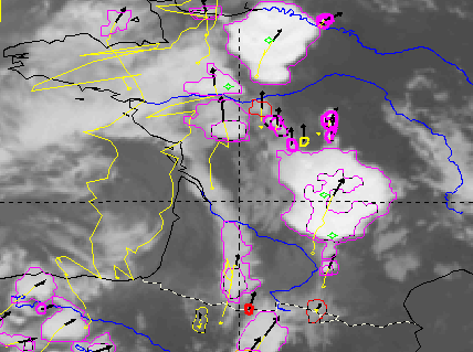
 slot 12h45 UTC (valid 12h56) |
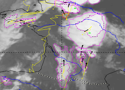
 slot 13h00 UTC (valid 13h11) |

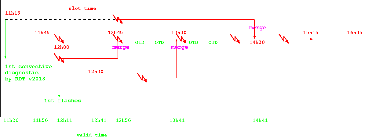
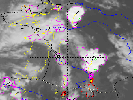
 First
diagnosed cell - slot 11h15
|
 First
impacts in 2nd main cell - slot 12h
|
 Big
merged cell before dissipation
|
 |
 |
 |
 15h45 |
 16h - 1 OTD | 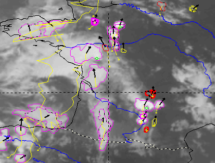 16h15 - 3 OTD |
 16h30 - 2 OTD |
 16h45 - 2 OTD |
 17h - 3 OTD | 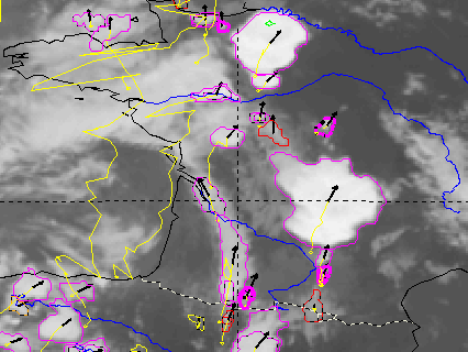 17h15 - 1 OTD |
 17h30 - 4 OTD |
 17h45 - 1 OTD |
 18h - 1 OTD | 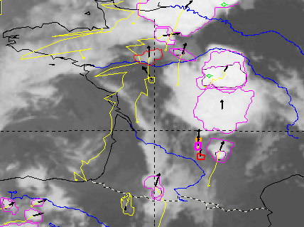 18h45 - 2 OTD |
 19h45 - 2 OTD |