
Convective Rainfall Products for Aviation (GEO v2018)
CRR (Convective Rainfall Rate) and CRR-Ph (Convective Rainfall Rate based on Microphysical Properties)
Convective Rainfal Rate products provide users with instantaneous rain rates (mm/h) associated with convective clouds and stratiform clouds related to convective episodes.
Applications related to Aviation
• Depiction of areas with heavy rain associated to storm clouds and tracking storm cells.
• As heavy rain comes from cumulonimbus and towering cumulus it gives an idea of areas of possible icing and turbulence associated to these clouds.
• It can be useful for a safe take-off and landing operations.
• Let users know the severity of a storm cell.
Limitations
• CRR tends to overestimate the precipitation area and underestimate the rain rates.
• CRR-Ph does not well detect low top warm tops at night-time. Sometimes the rain area is overestimated due to the cold cirrus extension at high levels associated with developed convective clouds also at night-time.
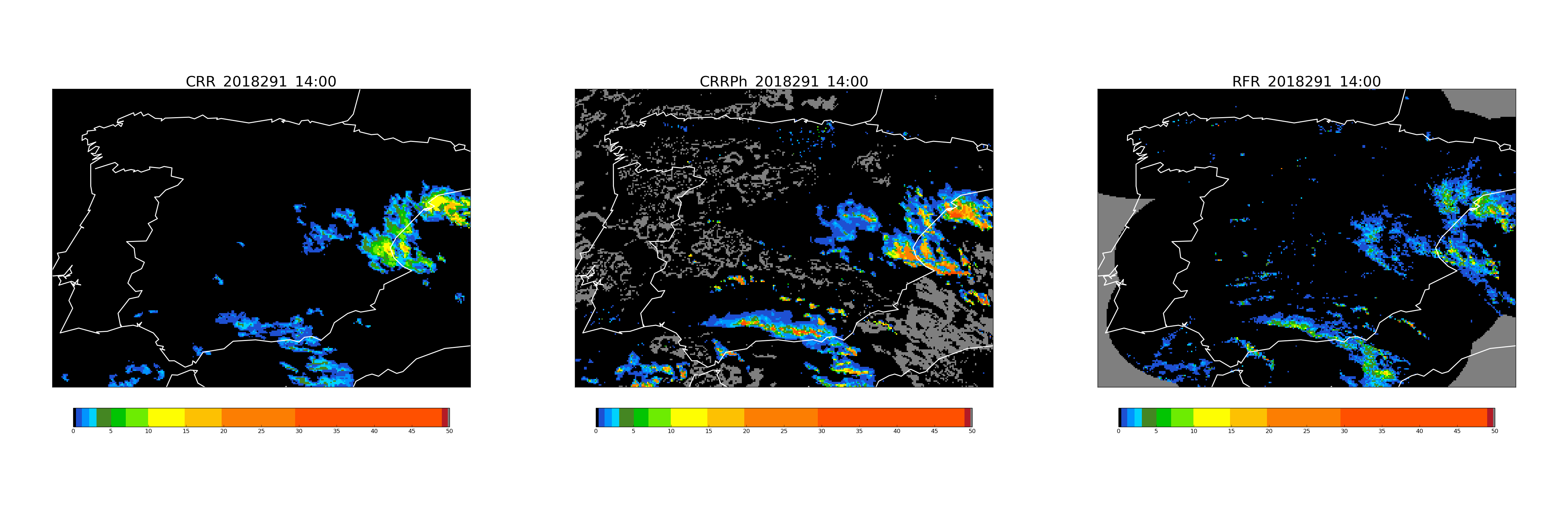
Images related to CRR, CRR-Ph and RFR (National Radar Composition) to Spain at 14:00 UTC. The units of the colour legend are in mm/h.
Note
At day time CRR-Ph gives a more accurate and detailed information.
More Information
To know more: CRR description and CRR-Ph description or the tab "Science" at http://www.nwcsaf.org
Real time displays of Precipitation products with MSG satellites over Europe and the Mediterranean Sea are available at:
CRR
CRR-Ph