
Canaries, 26.10.2016. Description
Synoptic situation
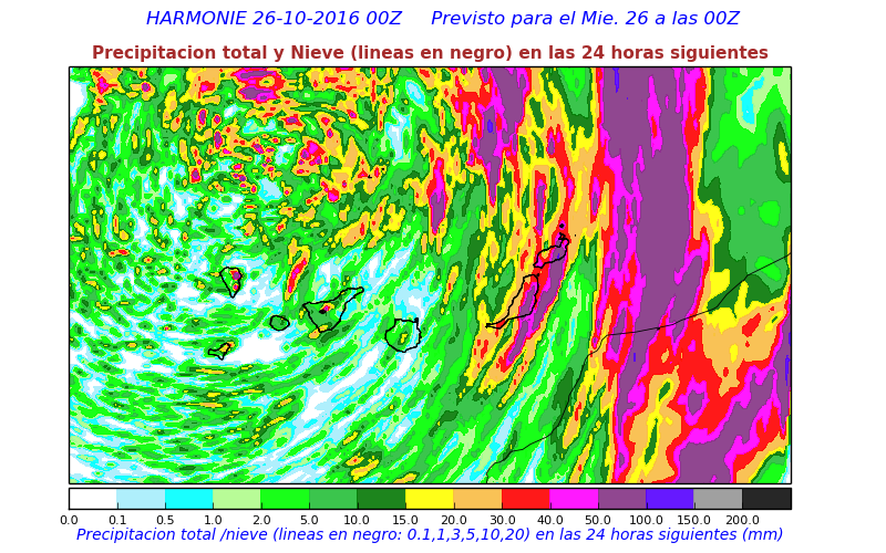
Heavy precipitation expected in the Canaries. In this region there is only one radar available. It is placed in a very high mountain and needs to cover a large region. Therefore the coverage is limited. NWC SAF precipitation products (CRR and CRR-Ph) can provide valuable information.
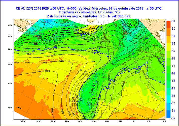
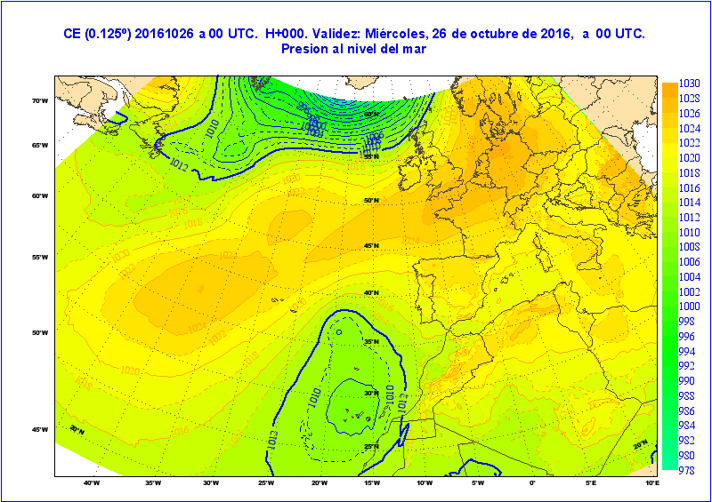
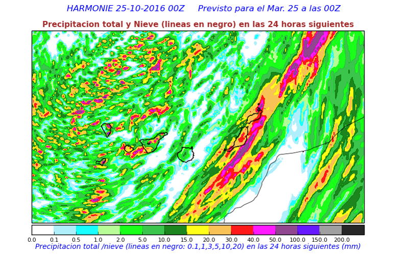
NWP Fields
Temperature and Pressure fields at 300 hPa expected at 00Z from 00Z forecast (Analysis)
Sea Level Pressure field expected at 00Z from 00Z forecast (Analysis)
Forecasted Total Precipitation 25.10.2016 between 00Z and 24 Z, forecasted at 00Z
Forecasted Total Precipitation 26.10.2016 between 00Z and 24Z, forecasted at 00Z
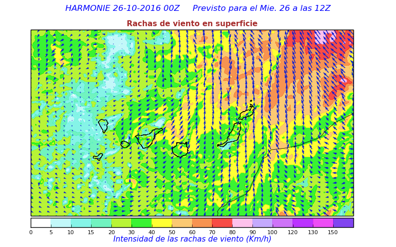
Forecasted Wind Gusts 26.10.2016 at 12Z, forecasted at 00Z
Forecasted Environment Favoring Convection
NWC SAF Products
Questions
- It is clear it will be a situation with convection. Can we distinguish from observations which island will be most affected at mid morning 26.10.2016 (09Z)? How much in advance can we predict this?
2. Was the total precipitation forecasted by the model accurate to regional (island) level?