
Topical Images Gallery
Selected Examples of NWCSAF products
This page is intended to provide examples with interesting and attractive images from the NWC SAF products.

Cloud Mask Ash Flag (CMa)
Ash Flag 12 hours synthesis from volcano Puyehue.
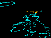
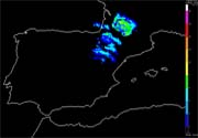
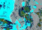
Cloud Mask Ash Flag (CMa)
Ash Flag from Icelandic volcano Grímsvötn.
Cloud Products (CMa, CT, CTTH)
Applications of the Cloud Mask (CMa), Cloud Type (CT) and Cloud Top Temperature and Height (CTTH) Products.

Cloud Mask (CMa)
Illustration of V2011 cloud detection improvement over cold ground in winter at night.
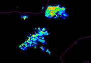
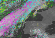
Convective Rainfall Rate (CRR)
Deep convective event occurred over Madeira on 20th February 2010.
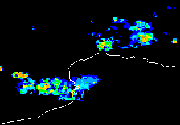
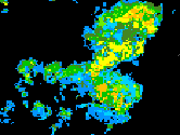
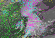
Convective Rainfall Rate (CRR)
Convective event in the northeast of Spain and the south of France. Convective Rainfall Rate, Radar instantaneous precipitations and lightning activity are displayed.
Convective Rainfall Rate (CRR)
Comparison between several remote sensing derived products for a severe storm ocurred the 20th May 2009 over Spain.
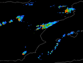
Convective Rainfall Rate (CRR)
Severe weather over the northeast of Spain and the southeast of France on July 2009.
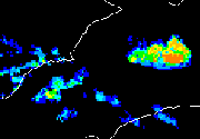
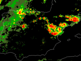
Convective Rainfall Rate (CRR)
Intense convective events over Spain on August 2009.
Convective Rainfall Rate (CRR)
Severe weather over Tenerife on 1stFebruary 2010.
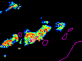
Convective Rainfall Rate (CRR)
Convection on 27th May 2010 over the Iberian Peninsula.
Convective Rainfall Rate (CRR)
Characteristics of CRR product, impact of different corrections, possible limitations and usefulness.
Convective Rainfall Rate from Cloud Physical Properties (CRPh)
Convective Rainfall rate from Cloud Physical Properties computed for a convective event occurred on 22 of August 2008.
Precipitating Clouds from Cloud Physical Properties (PCPh)
Precipitating Clouds from Cloud Physical Properties computed for a convective event occurred on 9th of September 2012.
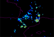
PPS Precipitating Clouds (PC)
PC product data from a noaa19 overpass.
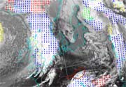
High Resolution Winds (HRW)
Evolution of Tropical Storm Gordon, in the vicinity of the Iberian Peninsula (html, 36 KB).
High Resolution Winds (HRW)
Evolution of Tropical Storm Gordon as cyclogenesis in the northwest of the Iberian Peninsula (html, 36 KB).
High Resolution Winds (HRW)
Strong Low Level Winds in Portugal (Case Study).
High Resolution Winds (HRW)
Rapid Cyclogenesis Xynthia (Case Study).
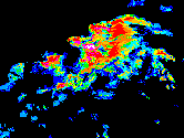
Rapid Developing Thunderstorms (RDT)
Severe Thunderstorm event over France, with heavy gusts and heavy hail, associated with convergence line. Strong diurnal convection over Adriatic edges.
Automatic Satellite Image Interpretation (ASII)
A cold front under warm air advection located over the North Sea is approaching Scandinavia (pdf, 12 KB)
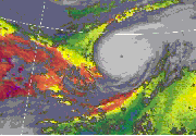
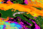
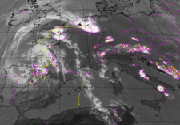
Precipitable Water (TPW, LPW)
Hurricane Gordon across the north Atlantic.
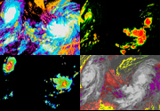
NWCSAF Products
NWCSAF products applied to hurricane scene (Danielle and Earl).