
Spain, 19.08.2015. Description
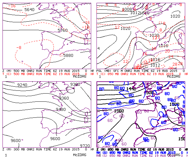
Synoptic Situation
Summer morning situtation in the West of Spain, next to the Mediterranean sea. Light and unstable fluxes from the East at low levels. Slightly cold in upper levels. Very warm sea. Some of these situations can be serious, others not.
NWP Fields
Synoptic situation
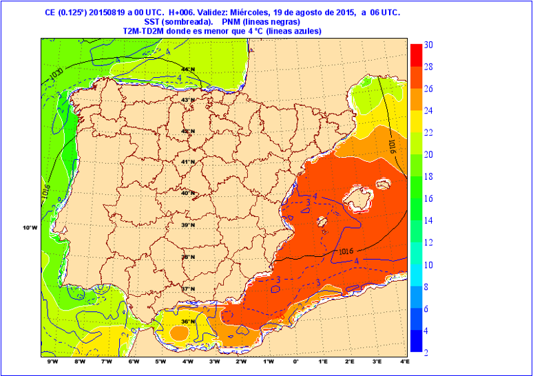
Temperature difference between the sea surface and 850 hPa is more than 10 K
Sea Surface Temperature at 06Z
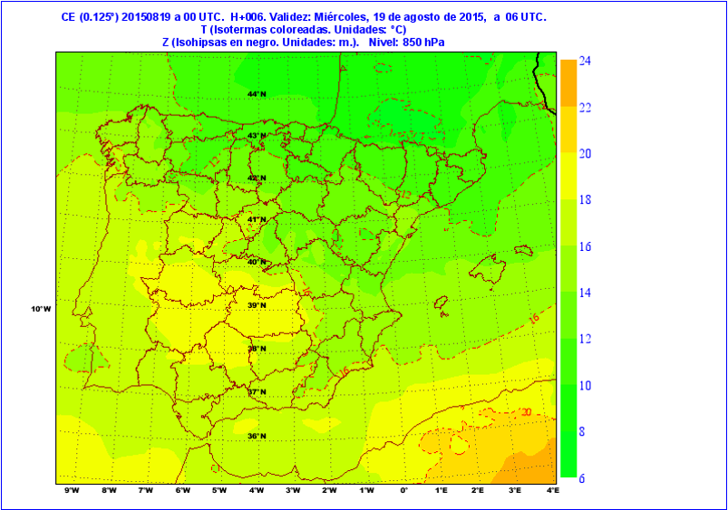
Temperature and geopotential field at 850 hPa at 06Z forecasted at 00Z
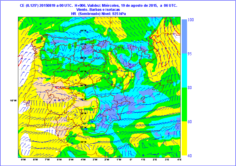
Unstable winds from the East at 925 hPa, also saturated and with convergence zones.
Winds at 925 hPa at 06Z forecasted at 00Z
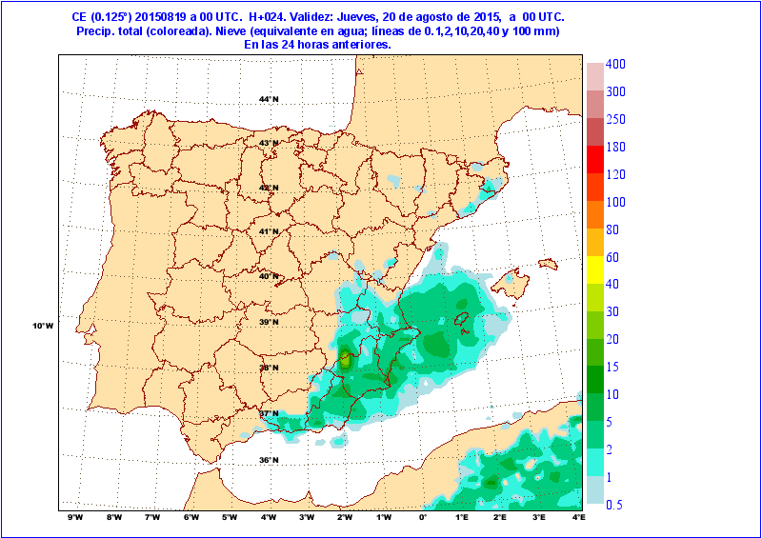
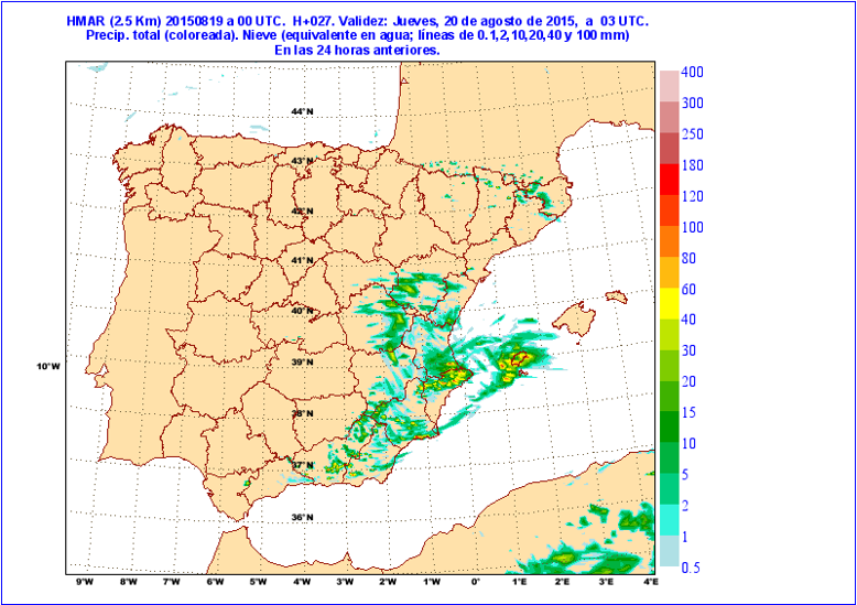
Similar precipitation patterns in ECMWF and Harmonie models
ECMWF expected Precipitation 19.08.2015 from 00Z to 24Z forecasted at 00Z
Harmonie expected Precipitation 19.08.2015 from 00Z to 24Z forecasted at 00Z
Places where it is likely to develop convection:
Environment favorable to Convection Loop
NWC SAF Products
Questions
1. Will a strong storm develop in this situation? Can the NWC SAF Products help us in this?
2. Is the iSHAI product anticipating anything unusual?
3. Are there any convergences seen by HRW?
4. Is the RDT product detection convection cells? When?
5. How did other remote sensing systems detect the situation?
6. Is the CI product anticipating any storms?