
Spain, 12.10.2016. Description
Synoptic Situation
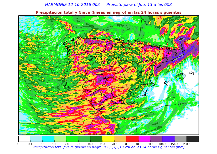
Heavy precipitation expected in the Mediterranean coast.
NWP Fields
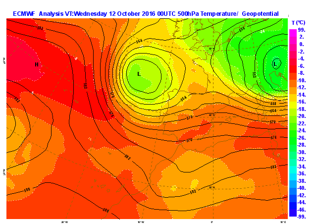
Temperature and Geopotential at 500 hPa at 00Z forecasted at 00Z (Analysis)
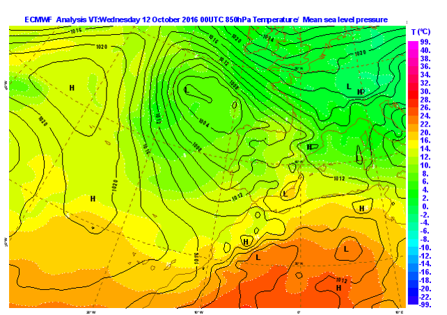
Temperature at 850 hPa and Mean sea level pressure at 00Z forecasted at 00Z (Analysis)
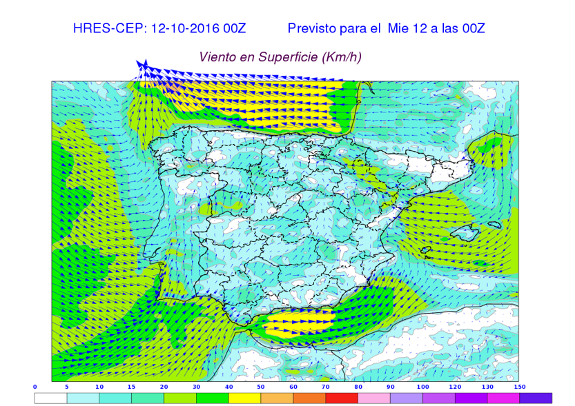
Surface Winds at 00Z forecasted at 00Z (Analysis)
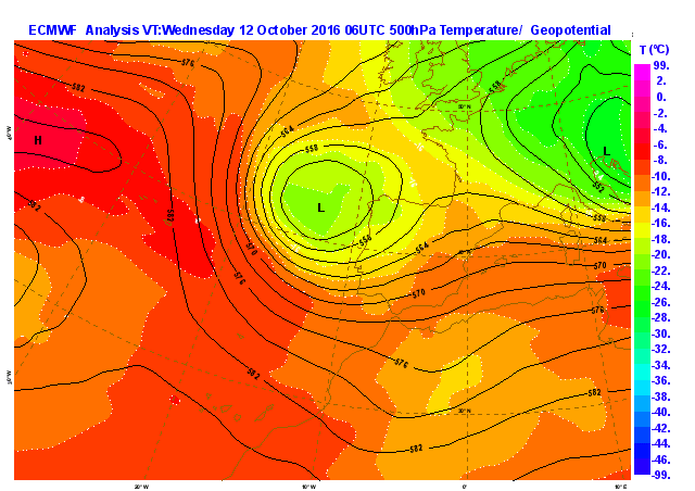
Temperature and Geopotential at 500 hPa at 06Z forecasted at 00Z
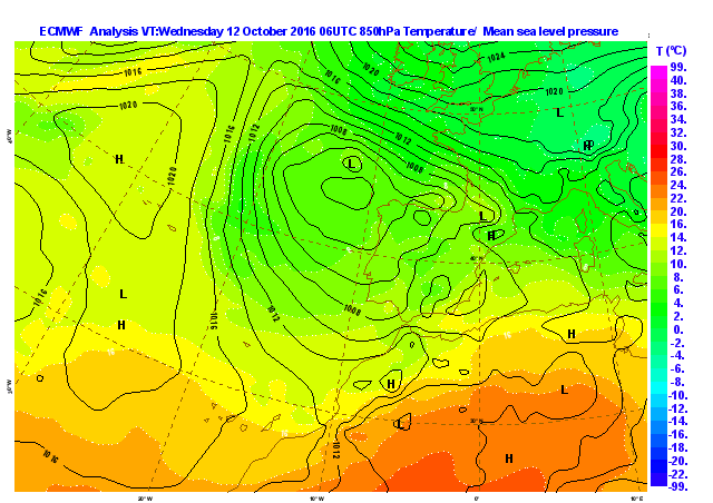
Temperature at 850 hPa and Mean sea level pressure at 06Z forecasted at 00Z
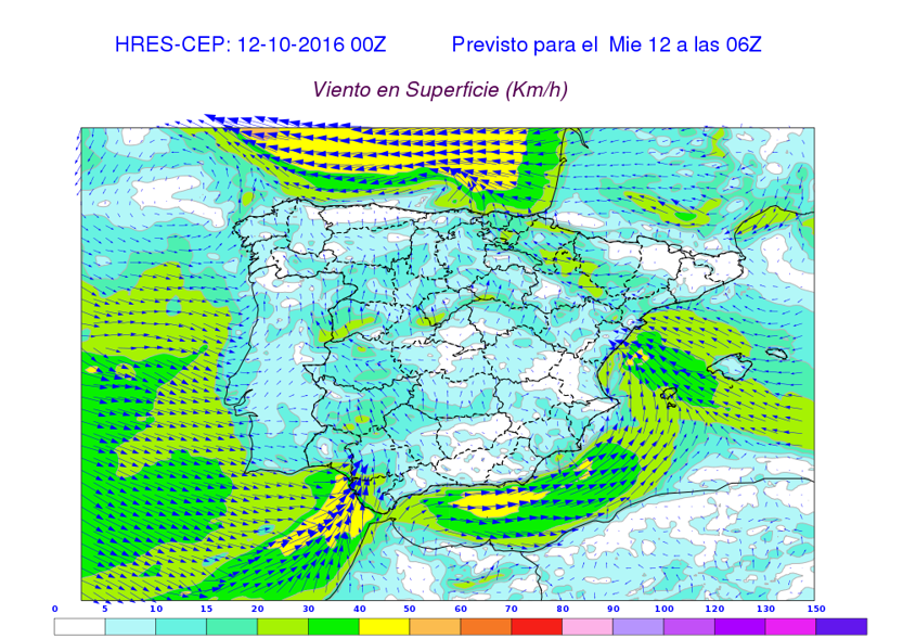
Surface Winds at 06Z forecasted at 00Z
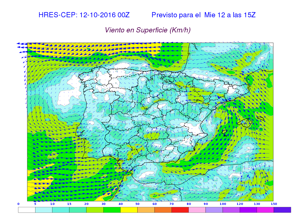
Surface Winds at 15Z forecasted at 00Z
Precipitation 12.10.2016 from 00Z to 24Z forecasted at 00Z
ECMWF Total Precipitable Water from 06Z to 24Z forecasted at 00Z
Precipitation from High Resolution model from 05Z to 16Z forecasted at 00Z
Precipitation "sticks" to the coast. Forced by inland winds and the mountains along the coast.
HiRes NWP Forecasted Precipitation Loop
NWC SAF Products
Questions
- NWP model forecasts precipitation along the Mediterreanean, "sticking" to the coast (look at NE Spain in HiRes NWP Forecasted Precipitation Loop). Surveillance of where a potential storm is going to be trigerred is mandatory. Which NWC SAF product or observation instrument will be able to discern where the storm is triggered?