
Cloud Products for Aviation (GEO v2018)
Cloud Mask
Apart from the identification of water or ice clouds, CMA provides on a pixel basis the identification of areas where dust or volcanic ash is present in the atmosphere. The aim is to identify rather thick dust events or significant volcanic eruption. Dust and volcanic ash products can be visualised and are more useful if animated or gathered into temporal synthesis, as illustrated below. Their interest for major events is for example documented with the the Eyjafjallajökull eruption (May 2010).
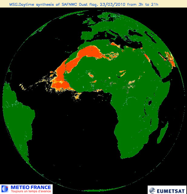
23/03/2010 – Synthesis of dust identified from MSG imagery over a 19h period (3h – 19h). A major dust event can be visualised (in orange colour) over north Africa spreading westwards over Atlantic ocean.
Dust identification is useful for aviation by giving an insight of the dust spatial extent near airports. It should be used in combination with RGB composite because the dust detection skill may be limited over continents except in case of major event.
Volcanic ash identification is useful for aviation as an input to VAAC (Volcanic Ash Advisory Center) which provide expertise to civil aviation in case significant volcanic eruptions.
Cloud Type
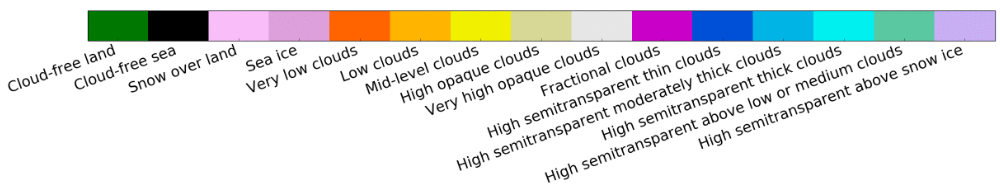
CT provides on a pixel basis the identification of the major cloud classes [low broken (fractional), high semi-transparent, high mid-level and low thick clouds] and the presence of grounds covered by snow. An animation of the cloud type product allows to analyze the meteorological situation and help to visualize convection or low clouds (that could correspond to fog, as over Dubai on the example below).
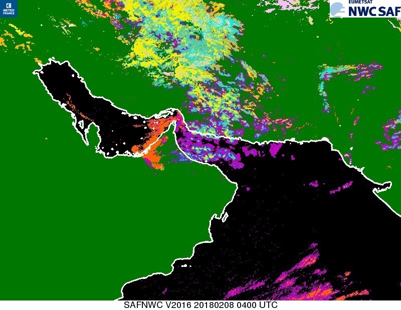
08/02/2018 – 4:00:00TU – Cloud type identification over East Africa. A patch of fog over Dubai and Abu Dabhi, classified as low clouds (orange) on the image, caused disturbance in airport (50 flights delayed) (https://gulfnews.com/uae/at-least-50-flights-delayed-as-fog-blankets-dubai-1.2170300).
CT can be useful for aviation by giving a general overview of the meteorological situation at a global scale and an insight of the temporal evolution of low clouds extent near any airport in the world (except near the poles).
Cloud Top Temperature Height
CTTH provides on a pixel basis the cloud top height (altitude in km and pressure in hPa) and cloud top temperature. CTTH is a pixel product that can be visualized with a colour palette (see below the cloud altitude for the Atsani typhoon) or used as input to numerical applications.
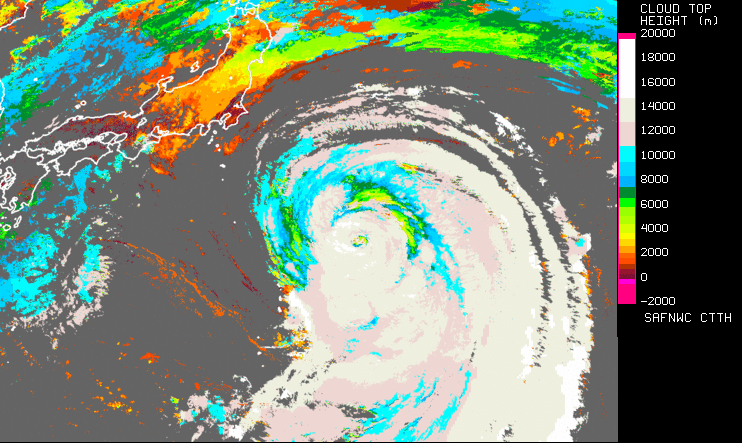
23/08/2015 – 02:00:00TU – Cloud top altitude (in meters) corresponding to the Atsani typhoon approaching Japanese coasts. Obtained from Himawari8 AHI imagery.
CTTH can be useful for aviation, especially by allowing the convective height assignment everywhere in the world (except over the poles). This information is included as an attribute to the RDT (rapidly developing thunderstorm product).
Cloud Microphysics
CMIC provides on a pixel basis information on the cloud microphysics (thermodynamic phase and size of crystal/water droplet at the top of the clouds, liquid and ice water path (integrated on the complete cloud vertical extension)). CMIC is a pixel product that can be visualized with a colour palette (see below the Ice Water Path for the Atsani typhoon) or used as input by numerical applications (such as computation of convective rain rate or estimation of High IWC (Ice Water Content) occurrence (which is a RDT (Rapidly Developing Thunderstorm) attributes)).
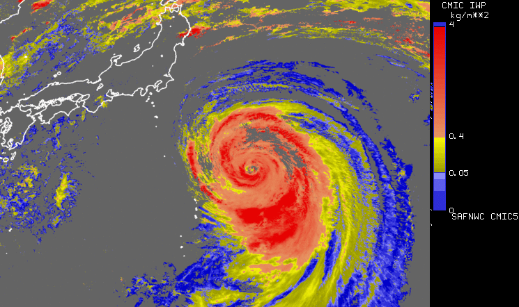
23/08/2015 – 02:00:00TU – Cloud Ice Water Path (in kg/m2) corresponding to the Atsani typhoon approaching Japanese coasts. Obtained from Himawari8 AHI imagery. The thickest part of the typhoon appears in red colours.
CMIC can be useful for aviation in case of convection (identification of cloud top glaciation or thickest part of clouds) or low cloud/fog (monitoring temporal evolution of low cloud water path).
More Information
To know more: CMA description, CT description, CTTH description, CMIC description or the tab "Science" at http://www.nwcsaf.org
Real time displays of Cloud product with MSG satellites over Europe and the Mediterranean Sea are available at:
CMA, CT, CTTH and CMIC